Introduction
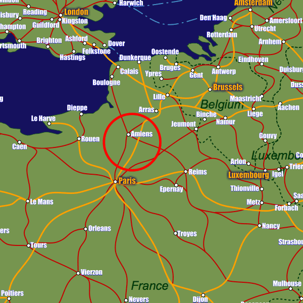
Amiens right in the north of France lies on the A16, the A29 and the A1 motorways which connect the town to the French road network. The Paris region is easily accessible via the A16 in approximately 1hr15m as is the British capital of London via the ports on the North Sea a short distance away. Normandy and the East of France (Reims) are also easily accessed via the A29 road. Thanks to its proximity to Paris, Charles-de-Gaulle airport provides convenient international services for Amien's inhabitants and visitors alike approximately 100km away; a more limited international airport is available 50km away in Beauvais-Tillé airport (also serving the Paris region).Lille, Brussels, Marseilles and Bordeaux amongst other destinations can be reached from Haute-Picardie station which is 20 minutes away from Amiens by direct bus service. This serves mostly TGV (High speed) routes, especially along the Lille-Paris route. In Amiens itself there are two stations; Gare d'Amiens (the former Gare du Nord) and Gare de Saint-Roch which lies at the Somme where the focus for visitors is inevitably the sad first world war history. Gare d'Amiens station is served by over 20 direct, daily services to Paris Nord with a journey time of approximately 1hr10m. Reims, Rouen and other local and regional destinations are also served by the town's railway stations.
Stations in Amiens
| Amiens | 1.0 km |
| St-Roch | 1.1 km |
| Amiens Cité Universitaire | 2.8 km |