Introduction
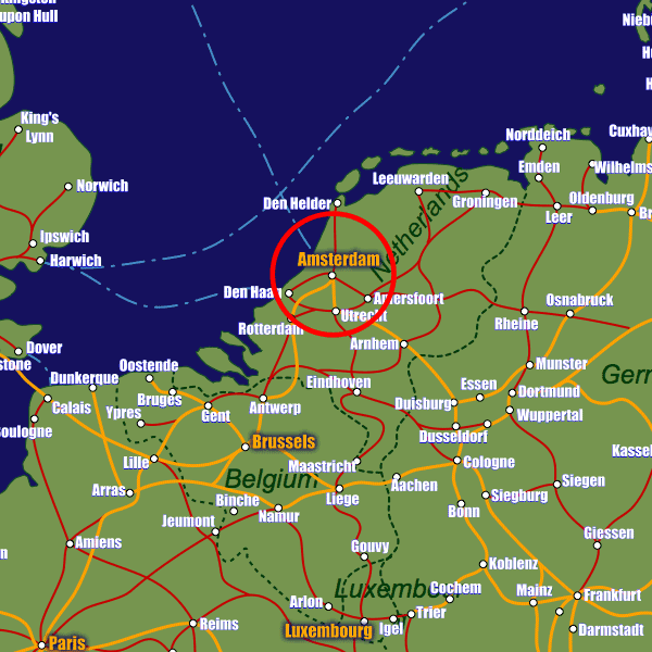
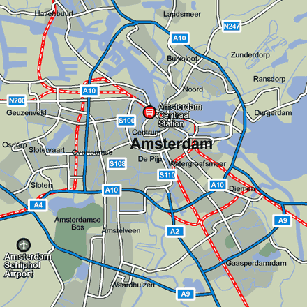
Schiphol airport (a main European hub for over 220 destinations) is 15km (9 miles) southwest of the city center, a train leaves every 9 minutes and delivers you to Centraal station in a shade under 15 minutes. The Centraal station is situated at the top of the immediate town center and is the hub of the city’s public transport network, with 12 different tram links, the metro and the major bus routes all converging here. The main tourist information office (VVV Amsterdam Tourist Office) is situated at Stationsplein 10, just opposite Centraal Station, visit www.visitamsterdam.nl for more information.Stations in Amsterdam
| Amsterdam-Centraal | 0.8 km |
| Amsterdam | 0.9 km |
| Amsterdam Muiderpoort | 3.1 km |