Introduction
Tours is often a stopping off point for travellers wanting to visit the Loire valley and the nearby Royal Château of Amboise.By rail, passengers can arrive at either of the two stations located in the town; Gare de Tours which is in the town centre and Gare de Saint-Pierre-des-Corps which is just east of Tours and serves most of the TGV trains. From here you can reach Paris (1hr), Charles de Gaulle airport (1hr30m), Strasbourg (4hrs) and Lille (2hrs30m) by direct service, amongst other destinations. Tours station itself also has direct services to Paris (1hr10m), although other TGV trains are more limited.
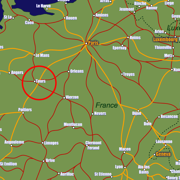
Tours lies on the Loire river in western France and is extremely well connected to the French motorway network. The A10 motorway from Paris to Bordeaux runs through the city, and the A85 passes along the southern outskirts and connects Tours with Angers to the west and Vierzon to the east. The A28 just north of Tours is a direct connection to Le Mans and destinations beyond.
Tours Loire Valley Airport is just 6km north-east of the city and operates several Ryan Air routes across Europe. London Stansted, Dublin, Marseille, Porto and Marrakesh airports are all served by regular flights.
Stations in Tours
| Tours | 0.5 km |
| St-Pierre-des-Corps | 2.7 km |
| Joué-lès-Tours | 4.7 km |