Introduction
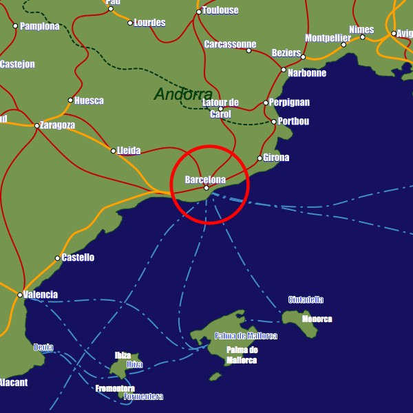
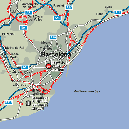
The airport is 13km (8miles) southwest of the city center, with a regular train able to take you to the city in just 15 minutes. Barcelona Sants Station (Estacio de Sants) in Placa del Paises Catalans is the city’s main station serving national, international and suburban routes. It is not within the city center but nevertheless located at the junction of two metro lines, the blue line (5) and green line (3), which offer easy access to the center. The main tourist information office (Centre d’Informacion Turisme de Barcelona) is situated at 17-S Placa de Catalunya (located below street level). Further offices can be found at the Central-Sants station and Placa Sant Jaume. Visit www.barcelonaturisme.com for more information.Stations in Barcelona
| Barcelona Plaça de Catalunya | 0.1 km |
| Barcelona Passeig de Gracia | 0.6 km |
| Barcelona | 0.9 km |