Introduction
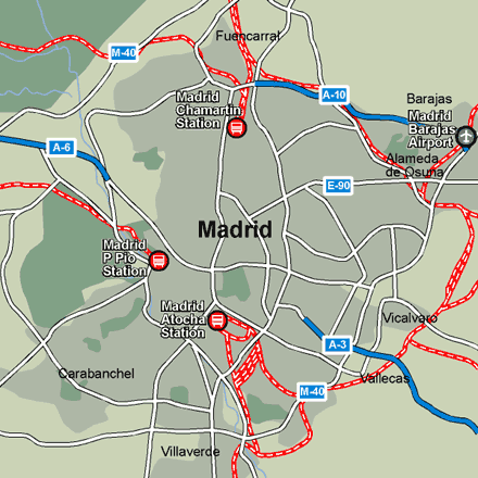
Madrid’s two main railway stations are Camartin in northern Madrid and Atocha in the south of the city. The first situated on San Augustin de Foxa Street is the city’s international station. It is connected to the center by metro and bus services and houses a tourist information office as well as facilities for booking accommodation. The latter is Madrid’s largest station and connected to the Cercanias suburban rail network. A third, smaller railway station situated near the Royal Palace on the west side of Madrid called Principe Pio or Norte is mainly for trains from northwest Spain. The Officina Municipal de Turismo (main tourism office) is on Plaza Mayor. For information on Madrid visit www.munimadrid.es.Stations in Madrid
| Madrid | 0.0 km |
| Madrid-Recoletos | 1.3 km |
| Madrid Príncipe Pio | 1.4 km |