Introduction
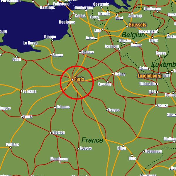
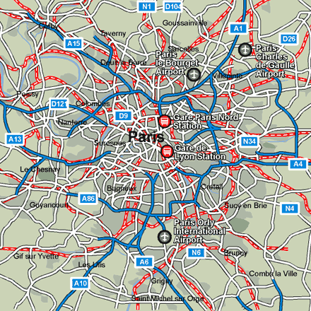
Paris is the railway hub of France as well as the rest of the continent; the city boasts six major international railway stations. The main one is the Gare de Lyon in eastern Paris. If arriving from the UK you will arrive at the Gare du Nord. The public transport network of buses, metro and RER trains serves all railway stations. Furthermore most of them have tourist information offices. There are seven tourist offices in the city, five of them at the railway stations one at the Eiffel Tower and one on the Champs-Elysees. Visit www.paris-touristoffice.com or www.paris.org for more information.Stations in Paris
| Paris Bercy Bourgogne-Pays d’Auvergne | 0.5 km |
| Paris Gare de Lyon | 1.2 km |
| Paris Austerlitz | 1.8 km |