Introduction
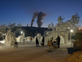
As the city is located around the Ruhr River, it has a rather unusual landscape defined by the way in which the river flows. Central Dortmund is quite dense in terms of the number of buildings per square kilometre, although it is also recognised for having large expanses of dedicated parks and green spaces, developed after the destruction of the central area following World War Two.Outside the city centre, the municipal areas are just as green with nearly half of the land covered with parks, waterways and woodland. The most notable of these parks are the Westfalenpark and the Rombergpark.
Stations in Dortmund
| Dortmund Stadthaus | 0.6 km |
| Dortmund Hbf | 0.7 km |
| Dortmund | 0.7 km |