Introduction
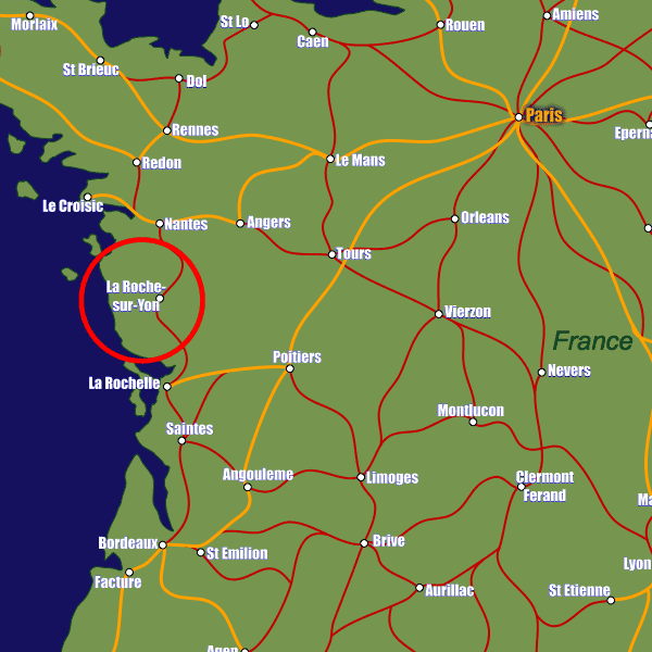
As the name suggests, La Roche-sur-Yon is a town lying on the river Yon in western France. Lying approximately 20km from the Bay of Biscay coast and 50km from the port town, La Rochelle, La Roche-sur-Yon is on the A87 motorway which gives direct access to Angers (1hr20m) and on the A83 which leads to Nantes (1hr).The Gare de La Roche-sur-Yon railway station located in the town centre is well connected to the French rail network. It lies on the line to Nantes, and is linked via the high-speed TGV trains to Les Sables d'Olonne (20m) and Paris Monteparnasse (3hrs).
Nantes Atlantique Airport is the closest major airport to La Roche-sur-Yon at just over 70km away. This airport is well served by a plethora of budget carriers and therefore offers a good-value entry and exit point into and out of France.
Stations in La Roche-sur-Yon
| La Roche-sur-Yon Place de Vendée | 0.7 km |
| La Roche-sur-Yon | 0.8 km |
| Les Clouzeaux | 9.1 km |