Introduction
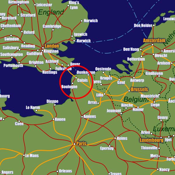
Calais lies on France's northern coast just 50km from the Belgium border. Being such an important port town (the third largest French port and the largest for passenger traffic), it is extremely well-connected to France's road network, with the A16 and A26 motorways both passing directly by the city. Calais also lies within 45km of Dunkirk, the country's other major passenger port and it is these two cities which share Calais-Dunkirk airport, a small largely freight airport approximately 7km outside of Calais. Lille Airport (120km away) is the closest airport which serves significant international destinations.The city is served by three train stations; Gare de Calais-Fréthun, Gare de Calais Les Fontinettes and Gare de Calais-Ville, the latter being the station that is closest to the port, approx 1km away (there are hourly shuttle buses between the port and the station). There are direct services to Lille-Flandres from Gare de Calais-Ville where you can transfer to Lille-Europe for the Eurostar route, or take a short journey to Calais-Fréthun station (located near to the Channel Tunnel entrance) from where InterCity, Eurostar and TGV high speed services to destinations including Paris leave.
Stations in Calais
| Calais Ville | 0.3 km |
| Calais | 0.4 km |
| Les Fontinettes | 1.0 km |